Trips Places Foods Stories Newsletters
Loading...
Loading...
Loading...
Loading...

No search results found for
“”

Make sure words are spelled correctly.

Try searching for a travel destination.

Places near me Random place

Popular Destinations

  • Paris
  • London
  • New York
  • Berlin
  • Rome
  • Los Angeles
Trips Places Foods Stories Newsletters
Sign In Join
Places near me Random place
All the United States Arizona Mesa Park of the Canals
AO Edited

Park of the Canals

This massive, ancient canal system was built using only sticks and stones.

Mesa, Arizona

Added By
cdanesh
Email
Been Here
Want to go
Added to list
CAPTION
  cdanesh / Atlas Obscura User
  cdanesh / Atlas Obscura User
  cdanesh / Atlas Obscura User
  cdanesh / Atlas Obscura User
  cdanesh / Atlas Obscura User
  cdanesh / Atlas Obscura User
Been Here
Want to go
Added to list

About

Despite its arid climate, agriculture flourished in Arizona’s Salt and Gila River valleys for thousands of years. The Hohokam Native Americans initially used floodwater farming to grow corn, beans, and squash close to the rivers. By the 7th century, communities built a system of giant canals at a scale not seen anywhere else in the Americas. The longest was 20 miles, with the whole network reaching up to 1,000 miles. Some near S’edav Va’aki were up to 85 feet wide and 20 feet deep. This allowed over 110,000 acres of land to be irrigated around Phoenix. With over 30,000 people, the area became the largest population in the southwestern United States.

The canals had specialized features such as weirs that directed water into them, and head gates that limited how much water entered them. They were able to maintain a constant flow rate and had a gradient of only a few feet per mile. As such, they were not prone to erosion or silt deposition. The political cooperation necessary to build and maintain the canals has been a matter of speculation today. The canals were not dug with shovels, but wooden sticks and stone “hoes” without handles that were used to loosen the soil, which was then removed by hand.

One mystery that remains is why and how these canals were abandoned in the 15th century. Some theories include a drought, the population straining the water supply, and fields becoming too saline. Today, the Hohokam's descendants, the O’odham people, continue to practice agriculture on a smaller scale.

Settlers crossing the United States were astonished by the then-dry canals. They realized that an agricultural civilization of immense complexity resided in the Salt River Valley, and named the city of Phoenix to reflect their hopes that a new settlement would rise from the ancient Hohokam ones. Settlers even began to reuse the canals for water once again. The Mormon founders of the City of Mesa were initially told that they could not channel water to their town, but instead found and used an ancient canal for irrigation. Today, many aqueducts in the Phoenix area follow the route of Hohokam canals, or were even constructed from the ancient canals themselves. 

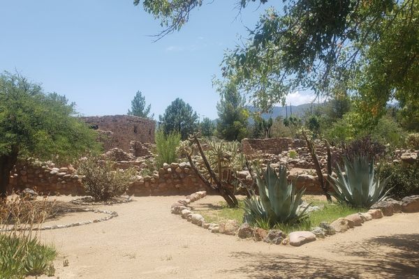
A portion of several interconnected canals, including one repurposed by Mormons only to again be abandoned, have been preserved at the Park of the Canals. A single path gives a view of the eroded canal ruins. Unfortunately, there are few descriptions on site and vegetation obscures some of what is left. But, one can use their imagination to picture how the canals were built and how they delivered water to a vast agricultural society over 500 years ago.

The grounds are also home to botanical garden, exploring the history of the natural landscape. 

Related Tags

Botanical Gardens Canals Mormons Native Americans

Know Before You Go

The site is open Monday through Thursday from 7 a.m. to 6 p.m. and is free to the public. 

Community Contributors

Added By

cdanesh

Published

March 7, 2025

Edit this listing

Make an Edit
Add Photos
Sources
  • https://www.azpm.org/s/98538-ancient-farmers-dug-canals-that-shaped-phoenixs-modern-water-system/
  • https://www.azcentral.com/story/opinion/op-ed/2014/03/29/canals-hohokam-history/7017779/#
  • http://www.waterhistory.org/histories/hohokam2/
Park of the Canals
1710 N Horne
Mesa, Arizona, 85203
United States
33.445535, -111.814208
Visit Website
Get Directions

Nearby Places

Organ Stop Pizza

Mesa, Arizona

miles away

The Stand

Scottsdale, Arizona

miles away

Eisendrath House

Tempe, Arizona

miles away

Explore the Destination Guide

Photo of Mesa

Mesa

Arizona

Places 2
Stories 1

Nearby Places

Organ Stop Pizza

Mesa, Arizona

miles away

The Stand

Scottsdale, Arizona

miles away

Eisendrath House

Tempe, Arizona

miles away

Explore the Destination Guide

Photo of Mesa

Mesa

Arizona

Places 2
Stories 1

Related Places

  • Globe, Arizona

    Besh-Ba-Gowah Archaeological Park and Museum

    The remains of a large pueblo village constructed by the Salado culture, who occupied the region more than 600 years ago.

  • Freiburg im Breisgau, Germany

    Krokodil im Kanal

    Local legend of a lurking canal crocodile takes on a life of its own with this sculpture.

  • Tampa, Florida

    Princess Ulele Statues

    Tampa’s most famous native royal comes alive in a duo of arresting bronze statues.

    Sponsored by VISIT TAMPA BAY
  • Kingston, Missouri

    Far West Temple Site

    This grassy field marks the site of a surprising religious conflict.

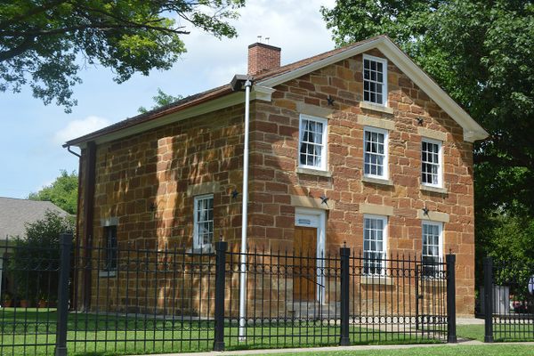
  • Carthage Jail restored to its 1844 appearance.

    Carthage, Illinois

    Carthage Jail

    The site where Joseph Smith, founder of the Latter Day Saint movement, was killed by a mob.

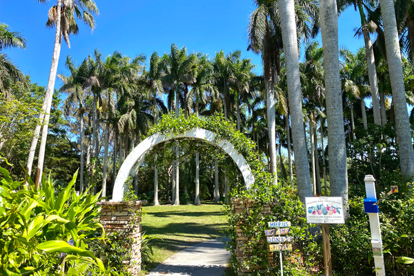
  • Palma Sola Botanical Park is a 10-acre park and gardens featuring a Rare Fruit Trail in northwest Bradenton.

    Bradenton, Florida

    Rare Fruit Trail at Palma Sola Botanical Park

    A wonderful world of rare fruits and flowering trees grows in a small botanical park in Bradenton.

    Sponsored by Bradenton Area Convention and Visitors Bureau
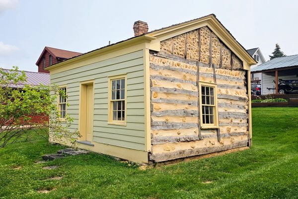
  • One side of the Dodge Mining Camp Cabin was exposed to its original 1827 appearance.

    Dodgeville, Wisconsin

    Dodge Mining Camp Cabin

    This 200-year-old cabin was the home of some of the first Wisconsin “badgers” and the site of the broken promises that led to their arrival.

  • Three Island Crossing as seen from the embankment above the river to the south.  This is also a unit of the state park.

    Glenns Ferry, Idaho

    Three Island Crossing State Park

    At the site of the most dangerous crossings on the Oregon Trail, a museum explores the complex history of westward migration in America.

Aerial image of Vietnam, displaying the picturesque rice terraces, characterized by their layered, verdant fields.
Atlas Obscura Membership

See Fewer Ads


Become an Atlas Obscura member and experience far fewer ads

Become a Member

Get Our Email Newsletter

Follow Us

Facebook YouTube Twitter Instagram Pinterest RSS Feed

Get the app

Download the App
Download on the Apple App Store Get it on Google Play
  • All Places
  • Latest Places
  • Most Popular
  • Places to Eat
  • Random
  • Nearby
  • Add a Place
  • Stories
  • Food & Drink
  • Itineraries
  • Lists
  • Puzzles
  • Video
  • Podcast
  • Newsletters
  • All Trips
  • Family Trip
  • Food & Drink
  • History & Culture
  • Wildlife & Nature
  • FAQ
  • Membership
  • Feedback & Ideas
  • Community Guidelines
  • Product Blog
  • Unique Gifts
  • Work With Us
  • About
  • FAQ
  • Advertise With Us
  • Advertising Guidelines
  • Privacy Policy
  • Cookie Policy
  • Terms of Use
Atlas Obscura

© 2025 Atlas Obscura. All Rights Reserved.