Trips Places Foods Stories Newsletters
Loading...
Loading...
Loading...
Loading...

No search results found for
“”

Make sure words are spelled correctly.

Try searching for a travel destination.

Places near me Random place

Popular Destinations

  • Paris
  • London
  • New York
  • Berlin
  • Rome
  • Los Angeles
Trips Places Foods Stories Newsletters
Sign In Join
Places near me Random place
All the United States Oregon Valley Falls Lake Abert

Lake Abert

Oregon's only closed-basin hypersaline lake, an important stopover for migrating waterfowl, is in danger of drying up completely.

Valley Falls, Oregon

Added By
slgwv
Email
Been Here
Want to go
Added to list
CAPTION
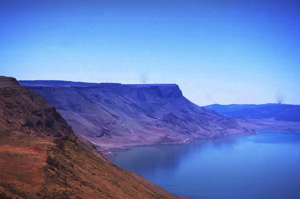
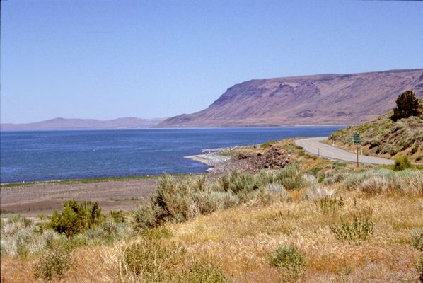
Lake Abert from the south. The highway is US 395. Abert Rim on the skyline.   slgwv / Atlas Obscura User
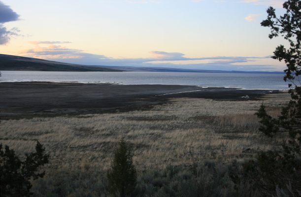
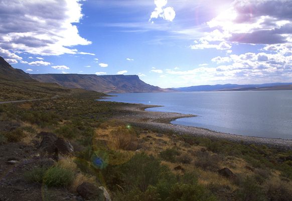
Lake Abert at sunset. Looking west.   slgwv / Atlas Obscura User
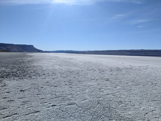
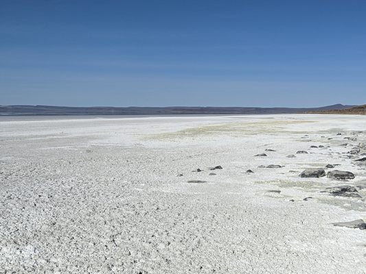
Dry Lake Abert in 2022.   Casie Smith
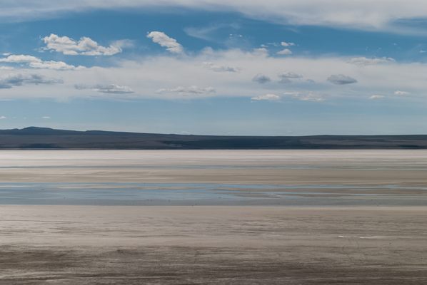
Looking west across nearly dry Lake Abert in 2014.   Shadowmeld Photography
Lake Abert (and the Abert Rim) from above. The highway running along the lake at the base of the escarpment is US-395.   BLM
Waterfowl viewing area on US 395.   BLM Oregon / CC BY-SA 2.0
Lake Abert at sunset. Looking west.   slgwv / Atlas Obscura User
Lake Abert at sunset. Looking north; Abert Rim on the skyline.   slgwv / Atlas Obscura User
Lake Abert looking south, off US-395.   BLM
Been Here
Want to go
Added to list

About

The slice of south-central Oregon that includes the Basin and Range fault-block structure represents the northernmost extent of the Great Basin. Lake Abert (pronounced "AY-bert") is a saline lake with no outlet to the sea, so its only water outlet is evaporation. The high salinity has resulted from the concentration of dissolved salts brought in over time.

Lake Abert is bounded on the east by the high fault scarp of the Abert Rim. The lake and the rim were named for John James Abert, the head of the Corps of Topographical Engineers, by explorer John C. Frémont. Frémont led an expedition through this area in 1843 under the auspices of the Corps.

The water of Lake Abert is much too salty for fish, but like other closed-basin saline lakes such as Mono Lake and the Great Salt Lake, it supports a population of brine shrimp. These shrimp are an invaluable food source for birds, and Lake Abert has traditionally been an important stopover for migrating waterfowl on the Pacific Flyway.

In recent years, however, water inflow has dwindled to the point that the brine is too salty even for the shrimp. The lake has even dried up completely several times. Drought, possibly exacerbated by climate change, has decreased the water inflow. But the main problem, as with other shrinking saline lakes, is upstream diversion of the water that feeds them.

The main water supply for Lake Abert is the Chewaucan (pronounced "SHEE-wah-cuhn") River, a landlocked river that rises in the Gearhart Mountains to the southwest. The Chewaucan is diverted for agriculture, and much of its flow is stored in a reservoir just upstream of Lake Abert.

Landlocked rivers, and the saline lakes they feed, occur elsewhere in the Great Basin, but farther to the south in Nevada, Utah, and California. This occurrence, however, is unique in Oregon. Hopefully a way will be found to preserve it. 

Related Tags

Migrations Birds Geology Water Salt Climate Change Lakes

Know Before You Go

US Highway 395 runs along the eastern shore of the lake with multiple viewpoints and access points. For the venturesome, some primitive 4wd roads access the western shore; consult an atlas, and realize they are likely to be washed out.

The nearest fuel is available in Lakeview, Oregon on US-395 some 22 miles south of Valley Falls.

Community Contributors

Added By

slgwv

Published

April 12, 2024

Edit this listing

Make an Edit
Add Photos
Sources
  • https://www.flickr.com/photos/blmoregon/15591687540
  • https://www.facebook.com/BLMOregon/photos/a.142647002423774.24515.121189811236160/1296176717070791/?type=3&theater
  • https://earthobservatory.nasa.gov/images/150891/shrinking-lake-abert#:~:text=The%20lake%20mostly%20dried%20up,for%20brine%20shrimp%20and%20flies.
Lake Abert
Valley Falls, Oregon, 97630
United States
42.630801, -120.230599
Visit Website

Nearby Places

Abert Rim

Valley Falls, Oregon

miles away

Paisley Five Mile Caves

Paisley, Oregon

miles away

Fremont National Recreation Trail

Paisley, Oregon

miles away

Explore the Destination Guide

Photo of Valley Falls

Valley Falls

Oregon

Places 2

Nearby Places

Abert Rim

Valley Falls, Oregon

miles away

Paisley Five Mile Caves

Paisley, Oregon

miles away

Fremont National Recreation Trail

Paisley, Oregon

miles away

Explore the Destination Guide

Photo of Valley Falls

Valley Falls

Oregon

Places 2

Related Places

  • The salt lake becomes colorful in warm temperatures because of algae growth

    Yuncheng, China

    Yuncheng Salt Lake

    Rainbow-hued in the summer and crystalline in the winter, this salty lake has inspired battles, temples, and plenty of awe.

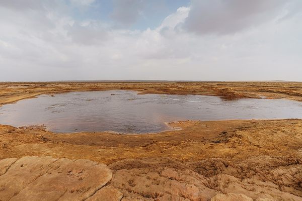
  • Gaet’ale Pond.

    Afar Zone 2, Ethiopia

    Gaet’ale Pond

    The Earth's saltiest natural body of water belches toxic gas.

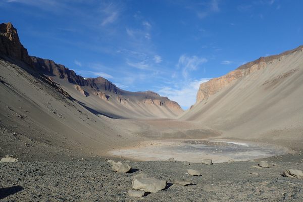
  • Don Juan Pond.

    Antarctica

    Don Juan Pond

    Scientists use one of the saltiest bodies of water on Earth as a terrestrial base for studying water on Mars.

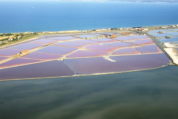
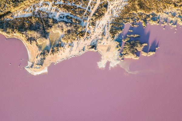
  • Laguna Rosa, Torrevieja, Spain

    Torrevieja, Spain

    The Pink Lake of Torrevieja

    Bacteria and algae give the salty water its bubblegum hue.

  • Soda and algae formations near the shore of Lake Natron.

    Monduli, Tanzania

    Lake Natron

    A salty red wasteland in Tanzania is a breeding spot for endangered flamingos.

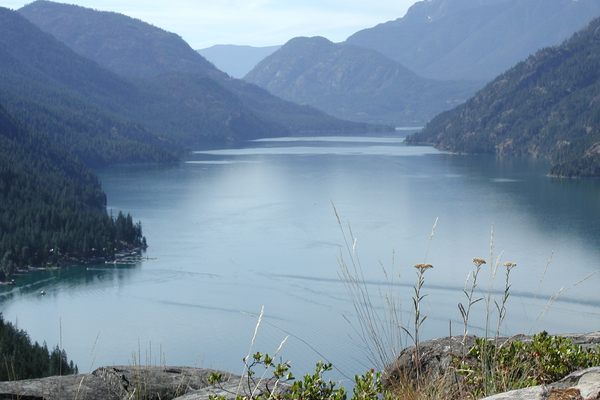
  • Lake Chelan above Stehekin (on shore to left).

    Washington

    Lake Chelan

    A narrow fjord-like lake, the third-deepest in the United States, runs for over 50 miles into the Cascades of Washington state.

  • An aerial view of the pink waters of Lake Atanasovsko.

    Nessebar, Bulgaria

    Lake Atanasovsko

    One of the world’s only pink lakes where it's possible to take a dip.

  • A view of the perfectly round Lac Pavin.

    Besse-et-Saint-Anastaise, France

    Lac Pavin

    This volcanic crater lake is renowned for its perfectly round shape, stunning blue-green waters, and unique geological properties.
Aerial image of Vietnam, displaying the picturesque rice terraces, characterized by their layered, verdant fields.
Atlas Obscura Membership

See Fewer Ads


Become an Atlas Obscura member and experience far fewer ads

Become a Member

Get Our Email Newsletter

Follow Us

Facebook YouTube Twitter Instagram Pinterest RSS Feed

Get the app

Download the App
Download on the Apple App Store Get it on Google Play
  • All Places
  • Latest Places
  • Most Popular
  • Places to Eat
  • Random
  • Nearby
  • Add a Place
  • Stories
  • Food & Drink
  • Itineraries
  • Lists
  • Puzzles
  • Video
  • Podcast
  • Newsletters
  • All Trips
  • Family Trip
  • Food & Drink
  • History & Culture
  • Wildlife & Nature
  • FAQ
  • Membership
  • Feedback & Ideas
  • Community Guidelines
  • Product Blog
  • Unique Gifts
  • Work With Us
  • About
  • FAQ
  • Advertise With Us
  • Advertising Guidelines
  • Privacy Policy
  • Cookie Policy
  • Terms of Use
Atlas Obscura

© 2025 Atlas Obscura. All Rights Reserved.